 Pristupačnost
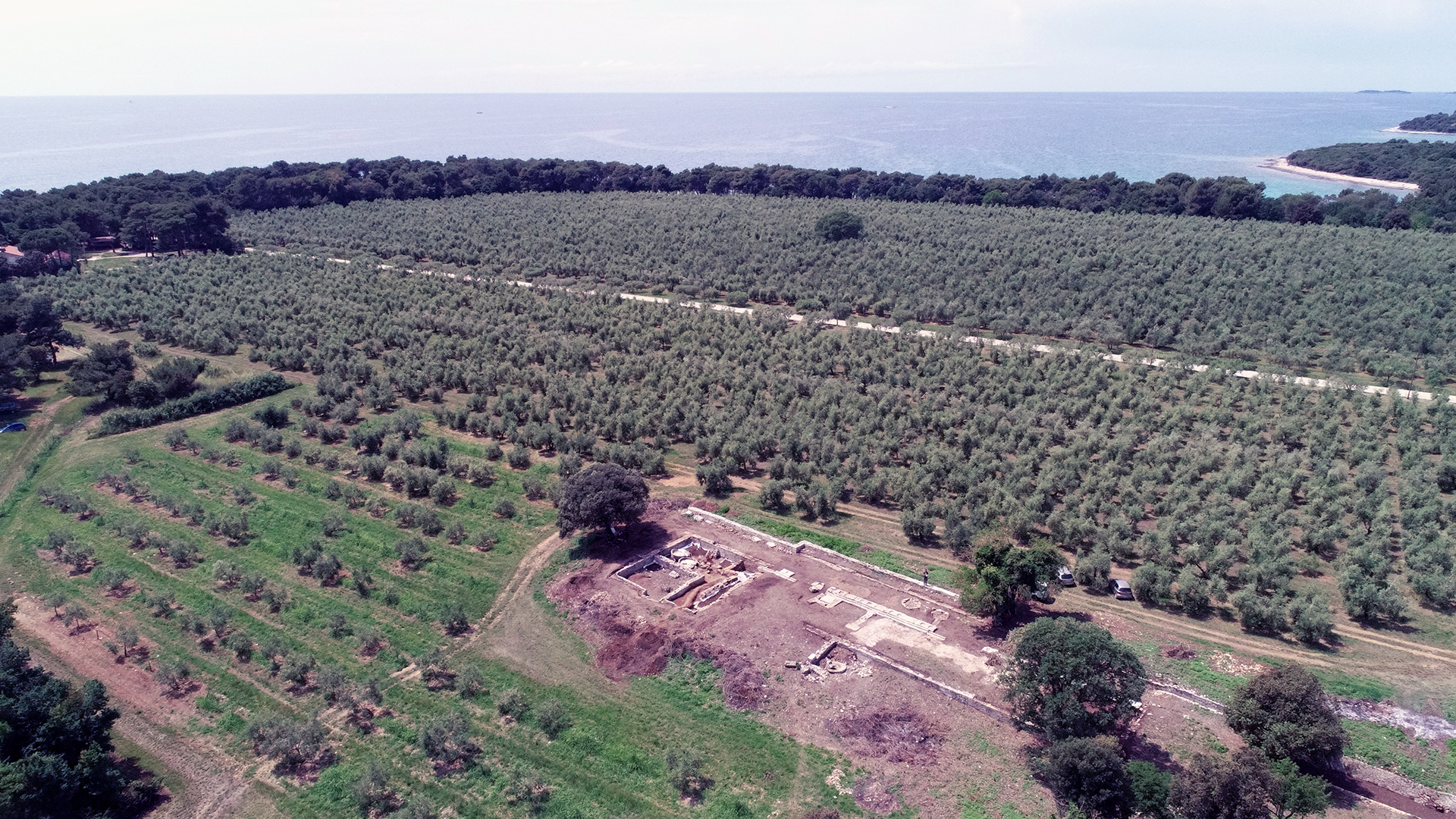
With the Roman colonization of Istria and the establishment of Roman colonies (Colonia Iulia Pola, Colonia Iulia Parentium) in the mid-1st century BC, significant demographic, economic, social, and spiritual transformations occurred. Newly established urban centres, as autonomous municipal communities, were accompanied by suburban areas (rus, ager), where these transformations were most visible. Human interventions in the landscape, such as intensive agricultural exploitation, land centuriation, and the construction of Roman villas, reshaped the colonial ager landscapes. Rural life in Roman civilization formed the foundation of the Roman economy and hosted various social activities within the villas. The intensive settlement of colonial ager and new forms of agricultural production greatly influenced environmental transformations.
In terms of settlement patterns, with the Roman colonization of the peninsula, there were shifts compared to the pre-Roman period. Elevated points and hilltop settlements typical of the earlier era were abandoned in favour of constructing Roman villas, a new type of settlement, located in lowland areas, on slopes, and inclines, aimed at rational agricultural production. The abandonment of prominent positions was also due to the loss of defensive strategic functions with the establishment of Pax Romana.
Recent studies of a Bronze Age settlement reoccupied in the early Roman period at the site of Monte Ricco near Vrsar reveal deviations from known rural settlement patterns in Roman Istria. Several unique features of the site's Roman phase stand out. The rural Roman settlement was located on a prominent hilltop, the site of a Bronze Age hillfort, contrary to the typical pattern of Roman rural settlements in lowlands. A second peculiarity lies in the relatively early construction date compared to other similar sites in Istria, associated with the period before Augustus, possibly around the mid or even second quarter of the 1st century BC, during or just before the foundation of the nearby colony of Parentium. The site shows continuous habitation until the end of the 1st century CE, unlike many similar Istrian sites, which often exhibit continuity into Late Antiquity or the Early Middle Ages.
A third noteworthy feature of this site is a square structure, only superficially defined so far, whose position, dimensions, and construction suggest it might be a fortification from the Late Republican or Early Imperial period, predating the full Roman pacification of the region. In this context, it is essential to define the functional characteristics of this rural site, which, due to these features, deviates from typical Roman villa rustica settlements in its earliest Roman phase. One initial hypothesis, pending confirmation or refutation through further research, posits that Monte Ricco’s primary purpose was supervisory or military in nature. Another hypothesis suggests that the site's earliest phase served as a rural estate of an Italic settler in the future colonial ager before the establishment of the nearby colony of Parentium. Given these distinctive features, further research on Monte Ricco as a case study will contribute to a better understanding of the early phases of Roman colonization, settlement, and the organization of colonial ager.
Despite the wealth of known Roman sites in Istria, most have never undergone systematic trial excavations. Geophysical surveys will form the basis for targeted trial excavations of selected sites. While data on settlement in ager during Late Antiquity are scarcer than those from the classical Roman period, the hypothesis assumes there were no significant interruptions in settlement between the Early Imperial and Late Antique/Early Medieval periods. This hypothesis requires confirmation through field investigations.
Research on colonial ager and Roman rural sites has historically relied on traditional excavation methods, often neglecting precise interpretations of stratigraphic contexts and mobile finds. Geoarchaeological sediment analyses and archaeobotanical studies of Roman rural sites in Istria remain unaddressed to date. These methodologies, alongside geophysical prospecting, will provide a comprehensive view of the layout, function, and landscape dynamics of Roman Istria over the last two millennia.
Research Methodology
- Archaeological Excavations
Archaeological excavations will collect data for ceramic, geoarchaeological, archaeobotanical, and architectural analyses, enabling chronological and typological classification of architectural remains and the interpretation of transformations at selected sites during their occupation. - Ceramic Analysis
Typo-chronological classifications of ceramics will provide insights into the nature of each site, the activities conducted there, their inclusion in broader exchange networks, and more. - Geoarchaeological Analysis
Environmental reconstruction will integrate pedo-sedimentological, micromorphological, geophysical, LiDAR, and archaeological data within a GIS framework to interpret landscape transformations over the past 2,000 years. The main objective is to identify natural and human-controlled (post-)depositional processes and assess soil erosion and slope processes to understand Roman settlement patterns. - Archaeobotanical Analysis
Archaeobotanical studies will contribute to reconstructing the environment, diet, and agricultural practices and serve as the basis for creating a future database of archaeobotanical data for Roman Istria. - Geophysical Surveys
Ground Penetrating Radar (GPR) and magnetometry will reveal the layout of Roman rural architecture at selected sites, forming the basis for trial archaeological excavations to interpret their stratigraphic and chronological context. - Survey and Reassessment
Field surveys aim to identify new and reassess previously recorded Roman sites. The data collected, combined with existing knowledge of Roman Istrian topography, will form the basis for developing a GIS database of rural Roman sites within the colonial ager of Parentium and Pola.
